So this seems to be a very novel idea. We've actually gotten out to explore some of our great wilderness on Vancouver Island! Of course, this trip wasn't meant to really explore new areas, it was more for scouting a new camping location for us. A campsite we've known about and visited many times, but never actually camped at. We've also been very tardy at getting out and exploring, mostly due to work, weather, and many other time consuming activities. But since we want to try out a new campsite, I needed to check the place over before hauling the trailer in.
I had worked a wedding the previous night, else this trip would've been done the previous day. We did a little work to Bernie's van to get a radio installed for her. We got it as far as the radio in and operating from a brand new gell-cell battery. We would complete the install at a later date. I knew the trip would be a bit later in the afternoon, so we planned it so that dinner would be in Port Alberni. A bit of a treat for the kids, but also meant we wouldn't be rushing in and back. I had fueled the truck up already, and was packing both junior tanks full of diesel. Good for a little extra weight.
The highway into town was not too bad, with relatively light traffic. I had thought of taking Taylor Main and going over Gracie Hill, but there was still too much snow on the logging road. So we cruised into towards town, taking Faber Road down to the pumphouse for the pulp mill. There I got on the logging road, first looking for the channel sign. It indicated RR-10A for Stirling Arm Main, but nothing for the direction we were going. I tuned RR-10A in anyway, but didn't bother with call-outs as it was a Sunday. We passed the motocross track a few moments later, noting it was quiet. Another couple minutes had us at the old log sort and climbing the first hill of Canal Main.
The GPS showed we had something like 20km to go, though that was in a straight line. With the road curving, climbing, and descending, it was more like 30km to the campsite. We did meet a few other private vehicles on the road, mostly heading towards town. I noted the road was in pretty good shape, indicating that active logging was taking place around the area. This contrasted with what Nick had told us, his version being the road was in pretty rough shape. But, some TLC with a grader, and the road can be turned into a highway. We fairly cruised down to the campsite.
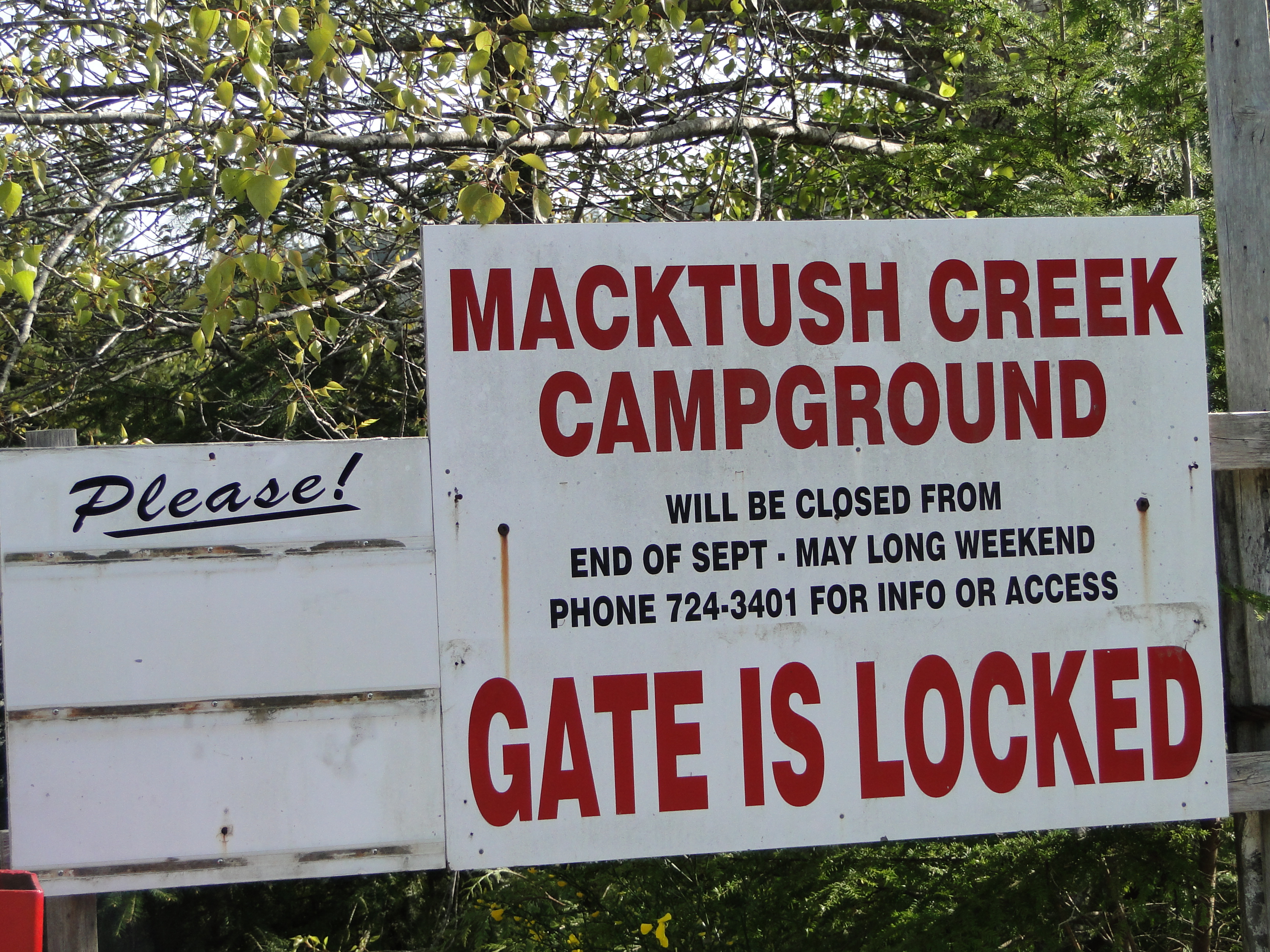
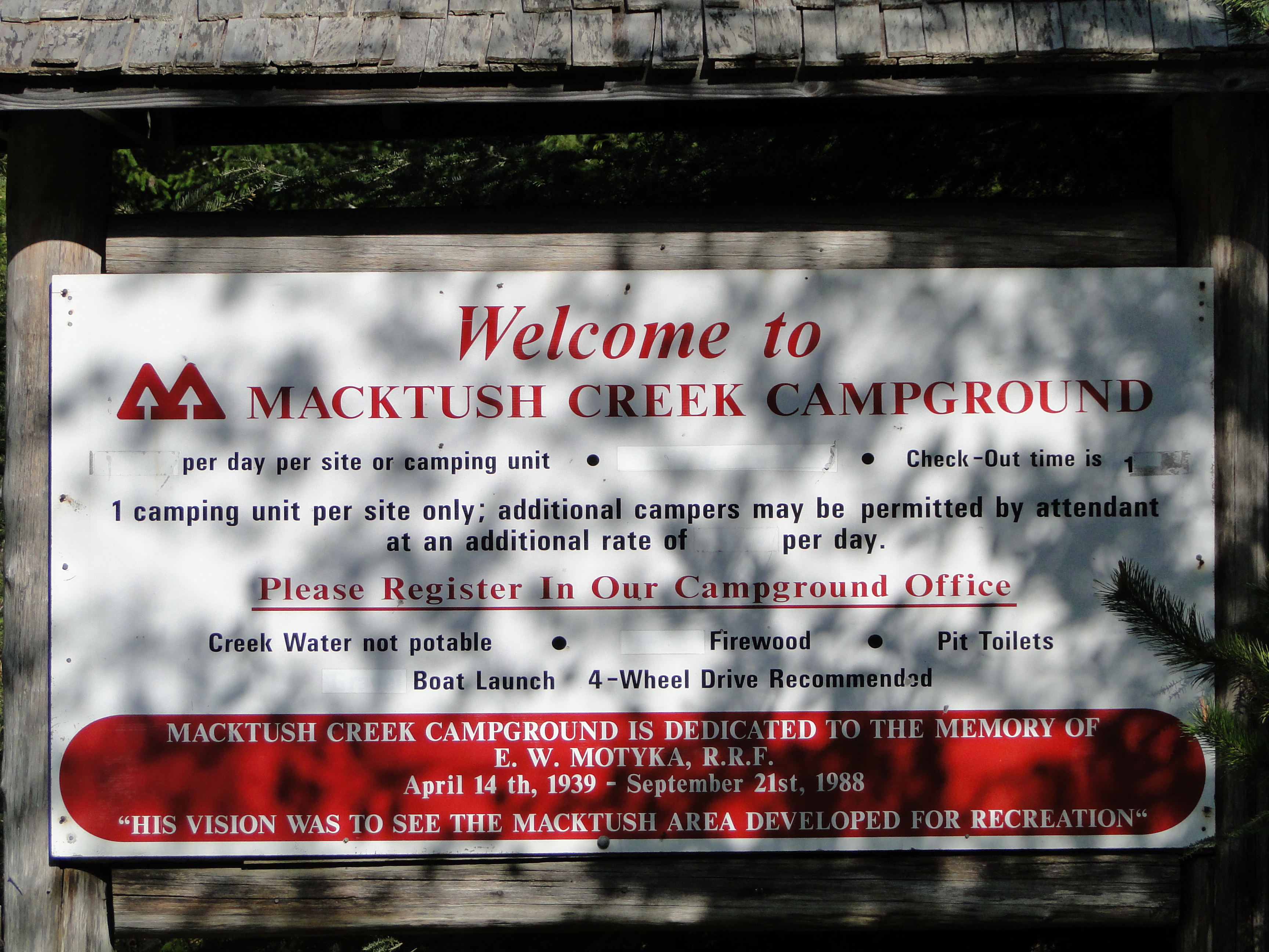
Upon arrival it was noted the gate was closed and locked. But a sign proclaimed that the campground would be fully open after the May long weekend and if we wanted access, it gave a number to call. I parked the truck so we could take a stroll through the place, figuring our most likely camp spot would be on the field somewhere. There were a few trailers already in the field in the different rows, but they looked to be stored there. One had fairly long grass growing under it; another appeared to have just been dropped off, given the tire tracks in the grass.
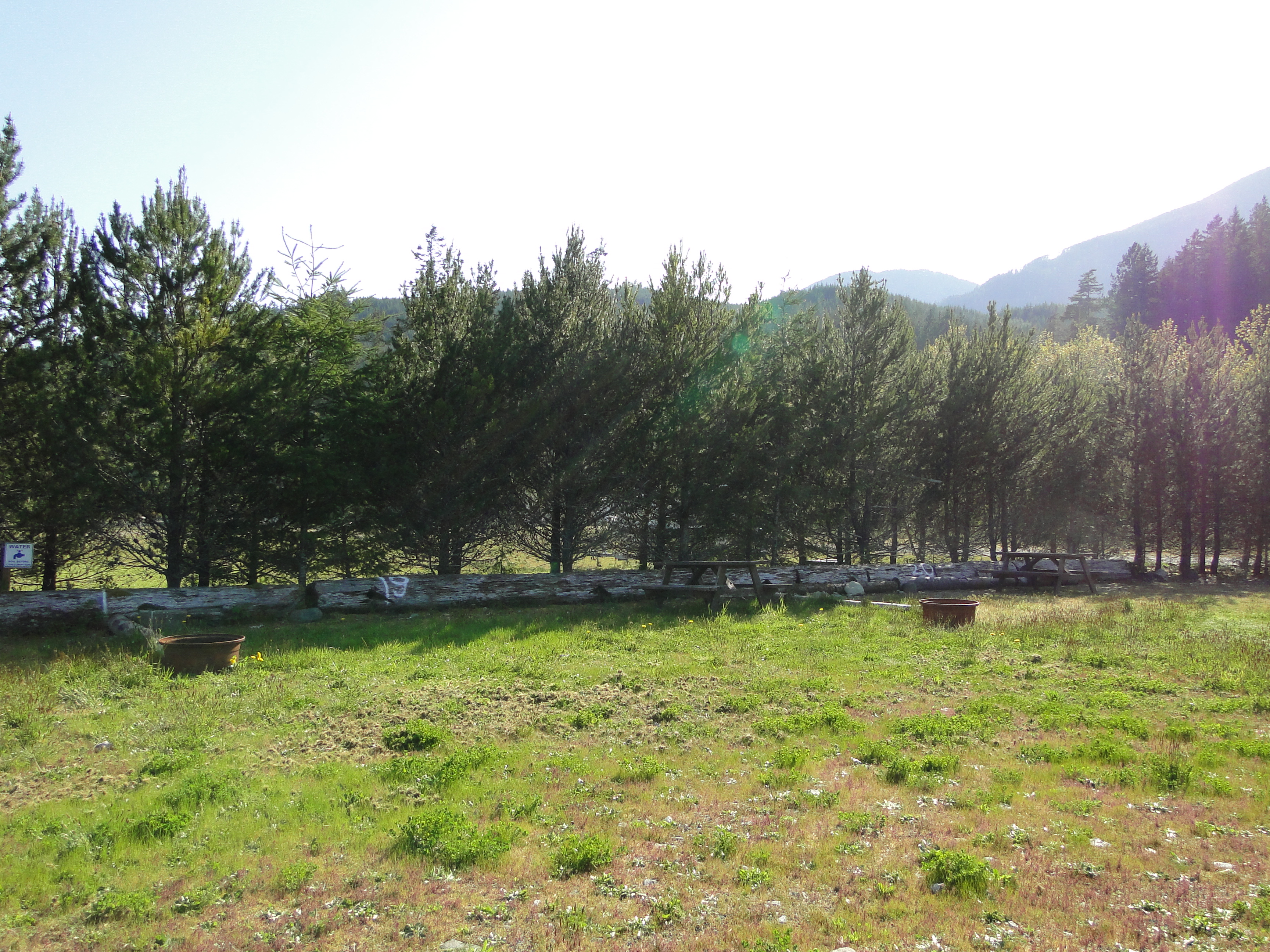
We wandered around for a while checking out the different rows in the field. These rows mark the camp spots, are marked along the backs with numbers, have picnic tables and fire rings, and all back onto a line of trees. We examined all the rows, and decided that the most likely row would be bottom one, as it was farthest from the road, and had outhouses part way along. The trees were acting somewhat like a wind break. I was glad we'd chosen to scout later in the afternoon as it gave us the chance to see what the afternoon winds would be like coming up the canal. And they were fairly strong. The trees in the camping row, while not fully stopping the wind, did serve to really slow it down, or deflect most of it. The rest I figured we could deal with using tarps.
I also noted, since it was a sunny day, that we should get quite a lot of solar power through the day. Even if we parked on the western end of any row, I figured the sun should disappear behind the mountains before the row-end trees would block it, at least to the trailer's panels. This might mean Lil Red would not get a workout. But that remains to be seen. I will pack the unit and fuel in case solar power doesn't work out very well.
As we slowly returned to the truck both boys thought that bringing their kites might be a good idea. Given the wind we were experiencing, they could have a blast with them. They also wanted their bikes, but I'm not sure that will happen. It will depend on whether there is room to put them in once I've packed the firewood and whatnot. We also noted that there is running water in the campground, but each tap is marked with a sign warning the water must be boiled before use. I figured a capful or 2 of bleach in the tank first should cleanse the water sufficiently. Besides, most of the water usage is for cleaning anyway. Any water consumed is usually in the form of tea or hot chocolate, meaning it is boiled in the kettle first.
Once back at the truck and all the pictures taken, it was time to return to civilization. We got moving north towars town. Bernie spotted a rather large ship in the canal, so since we were close to Arden Creek campground, I whipped us in there to have a look. The freighter Young Spirit was southbound after picking up a load of logs in Port Alberni. We sat and watched till she was out of sight, then maneuvered the truck back through the campground and onto the main road. Bernie commented there was no way we'd camp in there with the trailer. I returned that the place was more for truck campers, and maybe tenters.
We made some good time heading back up the logging road. I had to play with the GPS some as for reasons unknown the puck was constantly dropping its fix, yet the internal receiver in the plotter was tracking nicely. I did notice it was starting to drift off the roadway at one point so forced the plotter to use the puck instead, which put us right back on the road. From there, we headed into town for dinner before returning to the coast to end the trip.
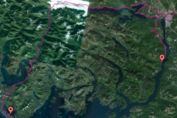
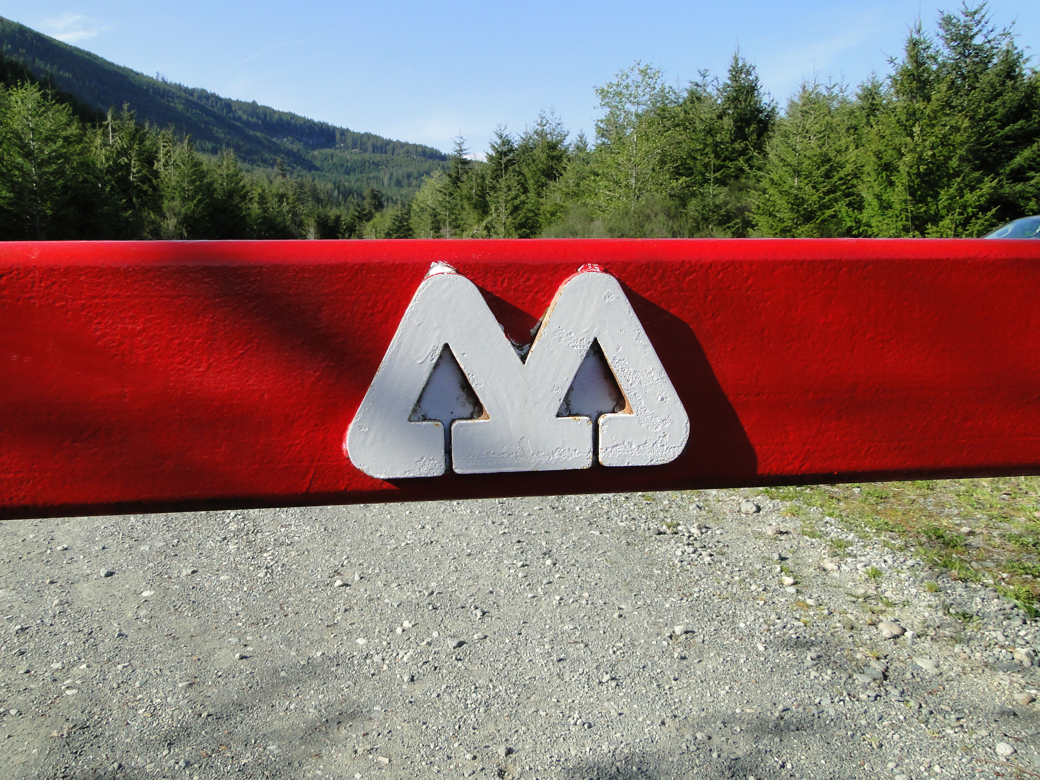
McTush Campground is a forestry campground located part way down the Alberni Canal, just north of Nahmint Bay. You can access the campground either by boat or by logging road. As of this writing, the logging road is active, at least during the week, so a VHF receiver is a good idea. The frequency is posted as you start the road. It is a 30km or so drive from the pavement, and the road is fairly twisty in spots, so take your time. Pretty much anything on wheels can do this trip, if you're careful. Also, here's our GPS Track. Happy Exploring!!